When I mention to people that I often travel to remote abandoned uranium mine sites as part of the remediation work SRC is doing for Project CLEANS (Cleanup of Abandoned Northern Sites), it’s hard for them to visualize what this looks like.
Uranium City is the closest town to these sites. Many people have heard of it and know that it’s somewhere way up in northern Saskatchewan. What most people don’t realize is we fly to Uranium City and then we get on another plane, a float plane that can land on water, which is the only way to get to some of the 37 sites that are part of our project.
During the fall of 2017, I flew to five of the sites (Caba, Don Henry, New Mylamaque, Pitch Ore and Territorial) to perform preliminary site investigations at each site with David Sanscartier, who is the project manager for the 35 Satellite Sites. Before we went to the sites, we did “desktop reviews” for each site, which involves researching everything we can about a historical mine site. This is not as easy as it sounds, as record keeping approximately 60 years ago is not what it is today.
A desktop review only gives us limited information of what the site might look like and hazards that may be present. Trips to the sites are important as they allow us to obtain preliminary site information, which is not available or can't be found during a desktop review. At site, we can collect samples and we also have the chance to update the historical records with new notes and colour photographs.
This reconnaissance trip in 2017 was special because it was the first time anyone at SRC had visited those five sites. It’s been more than 60 years since these sites were operational, so it was exciting to think about what we would find as they’ve been mostly undisturbed all these years.
Igniting the inner explorer
When I first stepped out of the plane, that’s when it hit me—we were alone, the nearest town far away. That feeling gets the adrenaline flowing. But these site visits were not without minor setbacks and challenges, like weather.
The first day our plane was delayed due to fog. Some of the days we had to deal with rain, which in autumn just adds to the difficulty of climbing rugged terrain with equipment as the bedrock can become very slippery and the bugs are aggressive. Then there’s also wildlife, such as moose, wolves and bears, which we had to be ready to encounter.
All these factors are intensified when you’re in an isolated area that is only accessible by plane.
We must be prepared for absolutely anything (even camping!), which is why we bring so many safety supplies. For some sites, we had to hike up to two kilometres from the plane to get to the location and we did this carrying rolls of safety fencing, sampling gear, radiation survey equipment and safety equipment, as well as food and water.
We also carry a two-way GPS device when out in the field, which allows us to text colleagues back in the office and let them know we have safely arrived at our destination. We have a satellite phone as a backup in case of more serious emergencies.
While an exploration trip like this excited the inner explorer in me, I also knew the challenges associated with this work. Mine closure regulations and rules were lax back in the day, so when the sites were abandoned, no safety measures were put in place. Based on my experiences at other Satellite Sites, I knew this would create challenges.
How we conduct preliminary site investigations
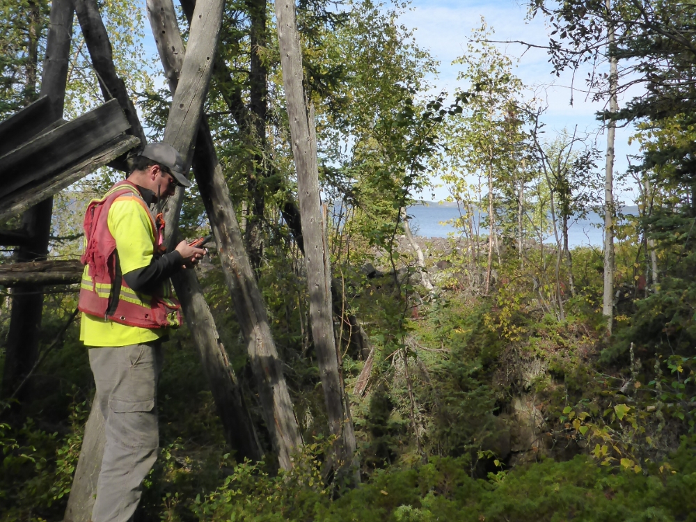
When exploring the sites, due care was taken as to where we walked as many of the sites had open raises or shafts. We used a mobile map app loaded with geo-referenced maps that showed locations of shafts, raises, adits and more—information we gathered during the desktop reviews. This allowed us to be aware of when we were approaching suspected areas with open raises or shafts.
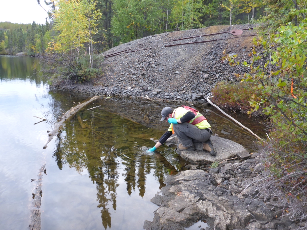
Once we discovered all the openings, we proceeded to fence them off to warn people of the dangers and to prevent any animals from falling into these open holes. Although the sites are very remote and difficult to access, people are known to visit them from time to time. After all the known safety hazards were identified and risks mitigated with safety fencing, we were then able to collect water, soil, waste rock and potential asbestos containing material samples.
When collecting water, soil and waste rock samples, we look for any element that is elevated and could be harmful to human health and the environment.
We collected potentially asbestos containing material to see if it contained asbestos. If it does, the material is considered hazardous and has to be collected and disposed of in a special manner when we come back to the site to remediate it.
We then conducted a preliminary gamma survey, where we walked around the sites to see if there were any areas with elevated radiation; uranium mining can leave elevated radiation above background levels. In the future, a detailed gamma survey will be done of the entire site. This makes sure no areas are missed and that we’ve satisfied governmental requirements.
The preliminary gamma survey also allowed me to explore the whole site and identify historic debris that may be present (ranging from old equipment to collapsed buildings and drilling equipment).
Why data matters
The data we collect shows us if problems exist with an abandoned site, such as elevated radiation and contamination. It helps us understand what work will be needed to remediate the site to safe levels.
For example, if the waste rock that was brought up from underground has high gamma radiation, the risk of the radiation would need to be assessed. Is it better to cover it or can we put it back down the mine? Or maybe there is nothing wrong with the waste rock. Or maybe it’s acidic and may produce acid rock drainage.
There’s a lot for us to consider before we decide on a remediation plan.
By collecting this data, running tests and consulting with other subject matter experts, we can develop a good remediation plan in the office so there are minimal surprises when we go back to these sites to do the work.
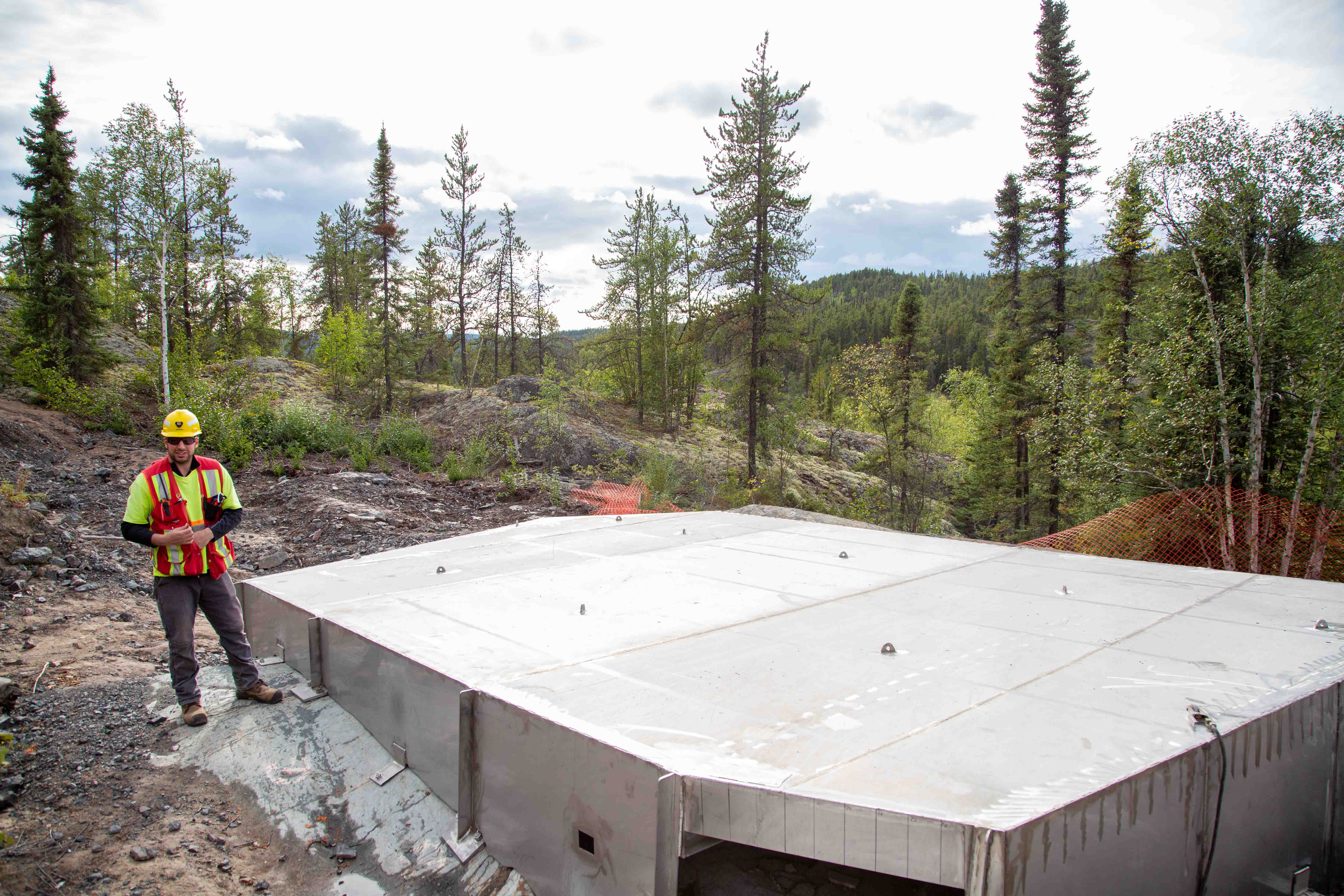
2019 field season
I just finished my third Project CLEANS field season at SRC and it was the busiest yet. We worked on the construction phase of remediation at six sites near Uranium City. This included installing a stainless-steel cap at Nesbitt Labine Eagle, installing stainless-steel grates on adits at Nesbitt Labine ABC and Rix Smitty, backfilling an adit at Strike Lake, covering areas with elevated gamma radiation, debris removal and remediating contaminated soil.
When mining underground in the 1950s, operators used to mine right up to the surface and there is potential for that rock to collapse over time if heavy equipment is driven over the area. So this past year, we also put up fencing at three sites around mined areas that are potentially unstable.
This project is important to me because I’ve worked in mining and it’s good to be on the environmental side now (at the other end of the mining cycle) and applying my expertise and experience to remediation work.
A fellow co-worker in another blog post said, “A bad day in the field is better than a good day in the office.” This is something I agree with and I’m thankful for the opportunity to work in my “other office,” no matter what surprises I may encounter.
