This is a contributed post written by former SRC employee Mark Johnston.
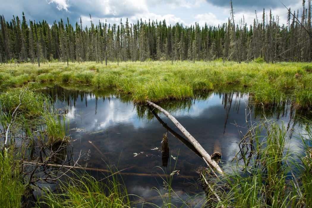
Most people consider a wetland to be an area that is covered with water and generally impassable.
They might be surprised to know that wetlands are hot spots of biodiversity in a forested landscape. A variety of species, including animals and plants, call wetlands home and don’t occur anywhere else in the forest landscape. Biodiversity is one of the main benefits of wetlands, but they’re also a huge reservoir of carbon. And it’s important to conserve wetlands to maintain that carbon in the ground.
WETLANDS VS UPLANDS
In a forested landscape, wetlands are where most of the carbon exists, as compared to upland forests where soils are shallower.
We know quite a bit about how to manage and maintain upland forests in ways that enhance carbon sequestration, such as planting different kinds of trees. But wetlands in forested environments, for the most part, aren’t under direct management, are typically difficult to operate in and are quite sensitive to things like heavy equipment. So we are just starting to learn about how wetlands capture carbon, and compared to our understanding of uplands, there is much more to learn.
HOW WETLANDS CAPTURE CARBON
Wetlands are a large carbon reservoir because as trees and other plants grow and die, their biomass is incorporated into the soil. But because wetlands occur in wet and cold conditions, the biomass doesn’t break down - it accumulates and gradually becomes peat over many centuries. It can be several metres deep in places. That dead biomass accumulating as peat is about 90 per cent carbon! Due to the lack of decomposition, peat deposits can be hundreds, even thousands, of years old.
If we have two to three metres of peat accumulation spread out over a large wetland, you’ve got a lot of carbon in that peat.
It’s important to maintain the vegetative cover and the hydrology of wetland areas because it maintains the peat and keeps the carbon in the ground. For example, if we put a road through a wetland, it could interrupt the way the water moves in the area. If the area dries up, the carbon would be lost.
WHY INDUSTRY IS PAYING ATTENTION
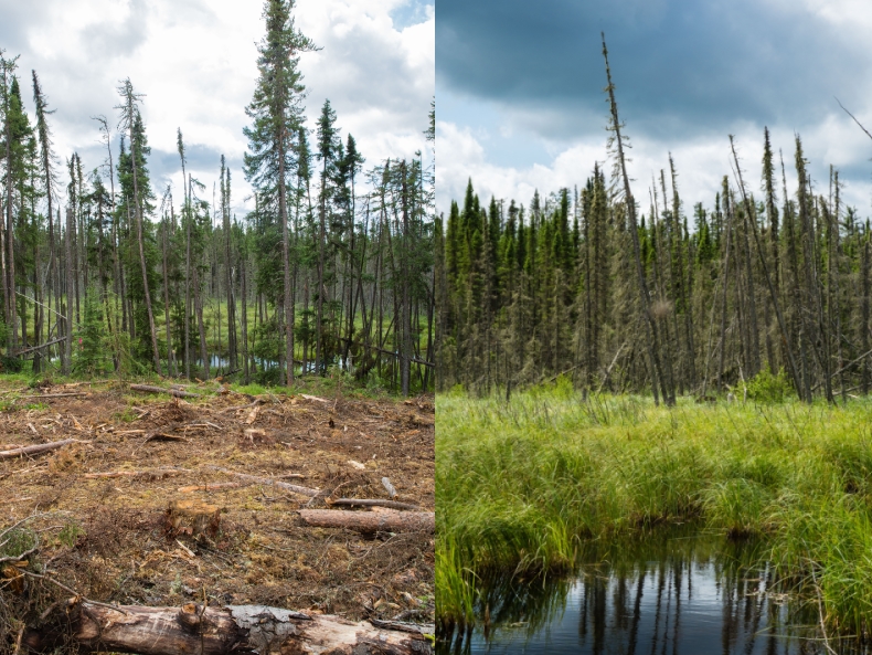
Historically, forestry activities have primarily been focused on upland areas. Wetlands are typically left off the table when companies consider their forest management strategies. That approach is changing.
Forestry companies are interested in taking more of a landscape perspective to their management plans (e.g., where and how they build roads), incorporating both uplands and wetlands. Even though they may probably not operate in wetlands, they still need to know how their activities in upland areas affect wetlands. Ducks Unlimited Canada and the Sustainable Forestry Initiative (two of our project partners) recently collaborated on developing a manual for forest managers that provides guidance on the location of roads near wetlands, which will reduce impacts to wetland hydrology.
MEASURING CARBON STORED IN WETLANDS
We’re in the second year of a three-year project to develop a rapid protocol that will provide estimates of carbon storage in wetlands. Funding for the project is through the Sustainable Forestry Initiative. The field work is provided by Louisiana-Pacific Canada and Spruce Products, Ltd on their landscape in Manitoba. Ducks Unlimited Canada has created maps to help us determine the sample points and has provided their extensive expertise in wetlands. It’s great to have a wide range of organizations on board who are interested in conserving wetlands.
In our first and second years, we’ve been out in the field collecting data to test the protocol to make sure it can be implemented by forestry professionals as part of their management activities. The technique is quite different than what is used for uplands. In year three, we’ll analyze the data and develop communication tools.
When North America was developed, there was a lot of wetland drainage for agriculture, particularly in the Great Plains and Prairie provinces, which resulted in a massive habitat loss, mainly for water fowl and other wetland dependent wildlife. Our team is taking every opportunity we can to make the point that we need to conserve the wetlands that are still on the forested landscape because of their values for biodiversity conservation.
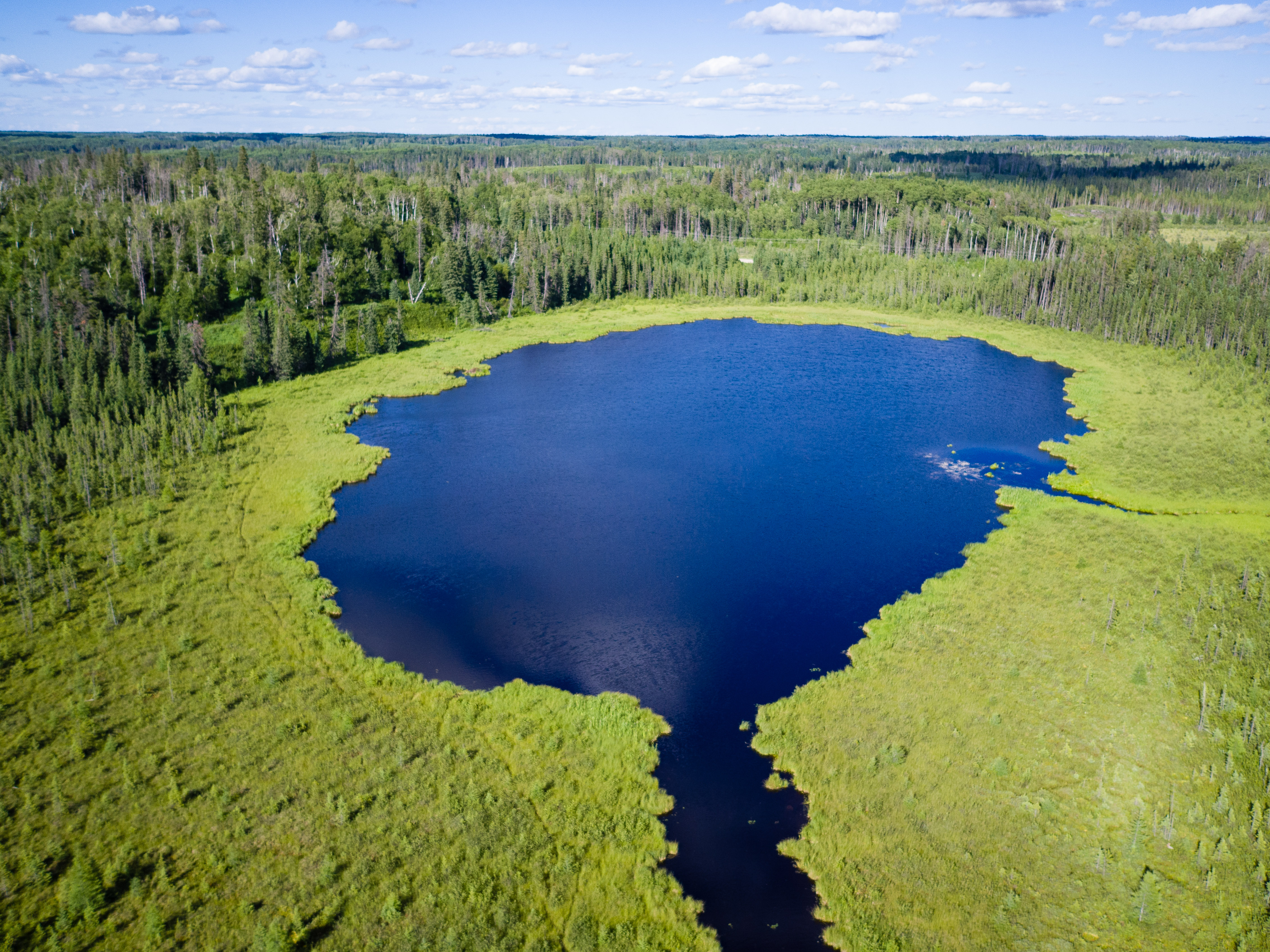
HOW WETLANDS ARE SAMPLED
Our goal is to sample all the different kinds of wetlands that occur on the landscape. Ducks Unlimited Canada mapped out the wetlands using their classification guide and the project team chose samples of each one. The area we’re sampling is near Swan River in Western Manitoba.
The sampling design is highly structured and repeated at every wetland so that we have comparable data. We run transects across the wetland and sample the peat every 30 metres with a long probe, measuring the peat depth and depth to water table to understand the hydrology.
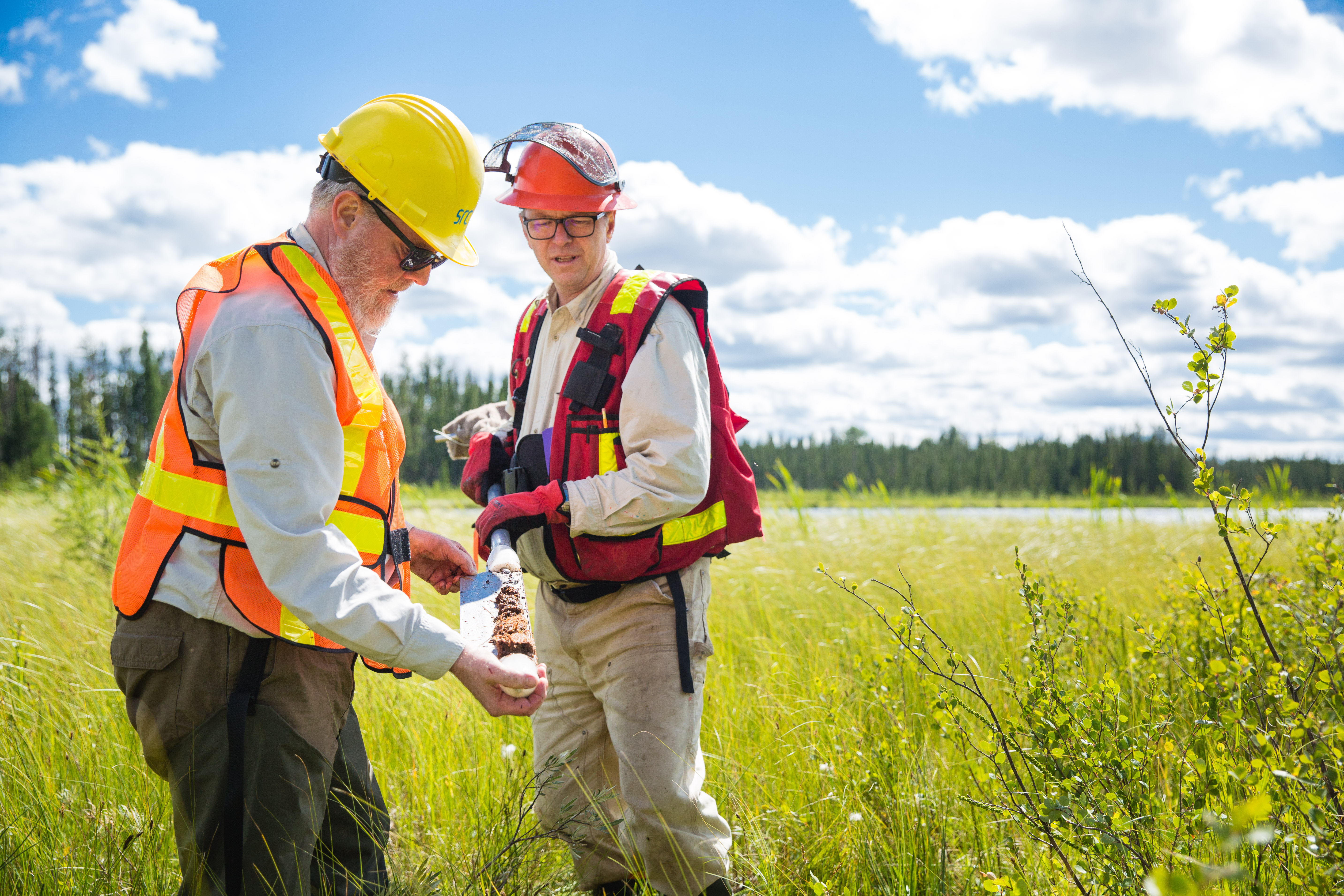
We also measure the acidity of the water, and we do a quick estimate of how much above-ground biomass is in the shrubs and trees. We use a special tool to extract cores from the peat, and the cores are sent to a laboratory at Brandon University, where the carbon content is determined.
We’ll use the data on depth, area of the wetland and the carbon content to determine how much carbon is stored in each of these wetlands. Then we can characterize for each wetland type, like a bog or a swamp or a fen, how much carbon is stored in each and which one holds the most.
THE RESULTS SO FAR AND NEXT STEPS
Although we’re still in the early stages of the project, we’ve found that the wetland types that maintain tree cover have more carbon than some of the other types that only have sedges. Our plan is to work with Louisiana-Pacific Canada to combine the carbon estimates we’ve generated in their upland forests with a map of the wetland area of their landscape. This way, we can assign carbon values to the different wetlands and have an integrated map that shows where the carbon is and how much there is, so that we can see – at a landscape level – where the important carbon reservoirs are.
Over the next year, we’re going to develop a practitioners’ guide book that will provide guidance to forest managers on how to collect the right kind of data to assess carbon in wetlands.
We – industry, society, government – need to understand how wetlands function, so that we’ll be able to do a better job of determining how our upland activities affect conditions in the wetlands. The right tools and analysis can help us figure out how to minimize our impacts and maintain the health of our ecosystems.
