The Saskatchewan Ortho-Photography Project produces seamless, accurate, vertical aerial photography and elevation data of Saskatchewan and its surface for use in geographic information systems (GIS). The project is managed by the Saskatchewan Geospatial Imagery Collaborative (SGIC), a group of organizations, including SRC, providing access to remotely-sensed satellite and aerial photographic imagery for mutual and public benefit.
SGIC provides free public viewing access to its basic imagery sets on the FlySask Website. SGIC members receive access to additional functions and high-resolution imagery.
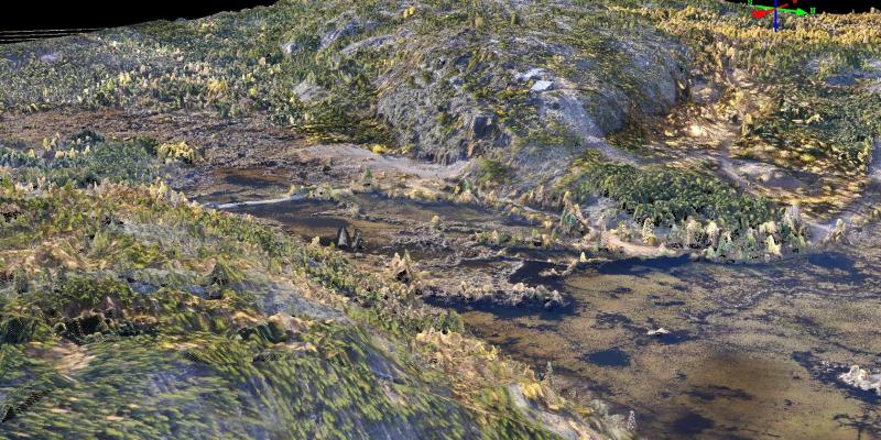
An ortho-photo is an aerial photograph that is geometrically correct that removes inaccuracies due to displacement, distortion, aircraft movement and camera tilt. This process of ortho-rectification, renders surface features with great accuracy and enables accurate measurements to be made from the image.
Aerial Image Acquisition: Capturing aerial imagery for small geographic areas is more cost-effective using SRC’s Unoccupied Aerial Vehicle (UAV) service. Learn more about our high-resolution aerial imagery service.
Product Availability
- Imagery products for members are available through the FlySask Website. Many other mapping layers can be overlaid to the ortho-imagery on the website, such as land location, roads, municipal boundaries, First Nations lands, parks and more.
- Internet viewing of the colour ortho-photography imagery is also available to the public through the FlySask Website.
- Web-Mapping Services (WMS) are available to members and industry for direct integration to corporate geographic information systems.
- Custom hard copy photo quality prints or digital data are available to the public by request.
Contact us to learn more about the Saskatchewan Ortho-Photography Project and member benefits.
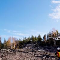
Aerial Image Acquisition - UAV
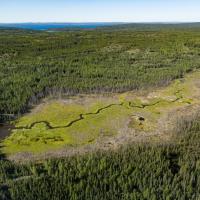
Ecosystems and Forestry Management